East Bay Bike Path
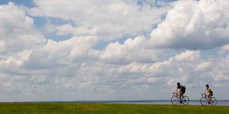
The East Bay Bike Path is the first multi-town bike path we built in Rhode Island. It travels 14.5 miles from India Point Park in Providence to Independence Park in Bristol, passing many state and local parks and recreation areas. Connecting neighborhoods, schools and business districts, the path is popular with commuting cyclists heading into Providence.
Get Map »
Note: Barrington and Palmer River Bike Path Bridges Closed Read More
Construction History
The bikeway was constructed in four phases from 1987 to 1992.
Chronological Listing
- Phase 1: Completed 1987 - Riverside Square to Barrington County Road (4.17 miles)
- Phase 2: Completed 1989 - County Road, Barrington, to Franklin Street, Warren (2.38 miles)
- Phase 3: Completed 1990 - Franklin Street, Warren, to Independence Park, Bristol (3.87 miles)
- Phase 4: Completed 1992 - Riverside Square to India Point Park, Providence (3.98 miles)
- George Redman Linear Park: Completed 2015 - Rebuilt bike path/pedestrian walkway and park over the Seekonk River. Project included switchback connections on both ends of the bridge (0.6 miles)
Path Features & Riding Experience
The path follows the former Providence and Bristol Railroad and is mostly flat, with the exception of a large hill as the path switches from an alignment alongside Veterans Memorial Parkway in East Providence to the former rail right-of-way. Learn more about the path's history.
Read More
- From India Point Park in Providence, you begin your ride on the Washington Bridge, off Gano Street and behind the Wyndham Garden hotel. The bridge is accessible via a switchback path that begins in the park and loops around the hotel. There also is a ramp system and staircase adjacent to the hotel parking lot. This part of the bike path was rebuilt in 2015 and dedicated as the George Redman Linear Park. It includes both a bikeway and pedestrian walkway, including a park area in the middle.
- The path enters East Providence along First Street before going off-road alongside Veterans Memorial Parkway. A split-rail fence and grassy area separate you from the roadway with a fairly steep incline before flattening out.
- In a short distance, you'll pass two parking lots which are popular starting points for riding the path.
- After the second lot, get ready for a steep downhill toward the waterfront and the former rail right-of-way. This is one of the most scenic sections of the bikeway, with the path running along a causeway with the Providence River at right and small coves on the left. Strong head winds are possible along this segment of the path.
- The path crosses through Kettle Point, which is being redeveloped for office and residential use with some connecting paths.
- After passing by Squantum Woods Park, riders pass through a long tunnel under Bullocks Point Avenue before reaching Riverside Square in East Providence. This is the first stop on the path for water, food and restrooms.
- The path then passes through a heavily wooded corridor of the bikeway and Haines State Park, which has picnic facilities and access to the water. Along the way the path crosses Crescent View Avenue. Turning right off the bikeway will take you to Crescent Park and a historic 1895 Looff carousel.
- Upon entering Barrington, you'll pass a number of interpretive signs along the path that identify nearby historical features.
- Approaching County Road, you'll pass close to a commercial corridor with many opportunities for food , including a large grocery store.
- The path is temporarily closed here, as the Department in 2019 closed two wooden bridges for safety reasons until they can be replaced. In the meantime, a signed detour has been established. Please walk your bike if you plan to continue south.
- Shortly after picking up the path at the Crescent Street access point, you'll cross Market Street and Child Street in Warren. Nearby are many shops and restaurants in the Main Street area and near Warren's waterfront.
- Continuing south, the path takes you toward Bristol and passes through less densely populated areas, with the occasional sweeping view of Narragansett Bay. Take a break and stroll along a long boardwalk built by the Audubon Society of Rhode Island, which leads to the water's edge. On the other side, a path leads up to the organization's environmental center.
- You'll soon cross the access road for Colt State Park, which has its own bike path network and sprawling fields that are great for picnics, kite-flying and other leisurely activities.
- Your ride ends at the water's edge again at Independence Park. Follow any of the side streets away from the water to explore historic Hope Street, home to the oldest Fourth of July celebration in the country.
Maintenance Questions
Spot graffiti, trash, or other maintenance problems? Contact the R.I. Department of Environmental Management, Division of Parks and Recreation at (401) 667-6200.
Barrington Bicycle-Pedestrian Advisory Committee (BPAC)
Parking Information
Directions to public parking along the bike path.