Washington Secondary Bike Path

The Washington Secondary Bike Path is the state's longest bike path at 19 miles from Cranston Street in Cranston to Log Bridge Road, just past Route 102, in western Coventry. It is named for the abandoned rail corridor once served by the Providence, Hartford, & Fishkill Railroad. Get Map »
The path is often referred to locally by the segment names given as the path was built, and these include, from west to east: Trestle Trail, Coventry Greenway, West Warwick Greenway, Warwick Bike Path, and Cranston Bike Path.
Construction History
The bikeway has been built in multiple phases since the late 1990s.
Chronological Listing
- 1997: The Town of Coventry opens the first segment of the Coventry Greenway, Station Street to Ayoho Road (1.5 miles)
- 1998: The Town of Coventry opens the second segment of the Coventry Greenway, Ayoho Road to Town Farm Road (1.2 miles)
- 2000: First Cranston Bike Path segment opened, West Natick Road to Howard Street (4.8 miles)
- 2000: First West Warwick Greenway segment opened, Providence Street to Hay Street (0.8 miles)
- 2001: Second Cranston Bike Path segment opened, Howard Street to Sumner Avenue (0.5 mile)
- 2003: Third Cranston Bike Path segment opened, Sumner Avenue to Depot Avenue (0.25 mile)
- 2003: Second West Warwick Greenway segment opened, Hay Street to Whitford Street in Coventry (2 miles)
- 2003: Warwick Bike Path segment opened, Providence Street to West Natick Road (1.6 miles)
- 2003: Old railroad bridges from Station Street to Whitford Street re-decked
- 2010: Third Coventry Greenway segment opened, Station Street to Whitford Street (1.6 miles)
- 2014: Original Coventry Greenway segments rehabilitated, Station Street to Town Farm Road (2.7 miles)
- 2014: Trestle Trail East opened, Town Farm Road to Log Bridge Road (4.8 miles)
- Construction is underway to rehabilitate old rail bridges along an gravel section of the path west of the current paved path. Paving of this section is subject to a cost and readiness review as is not currently scheduled.
Path Features & Riding Experience
As the path follows the former rail corridor, it is mostly flat but has a gradual downhill slope heading from west to east. The greatest elevation change is on the Trestle Trail segment. For more than half its length, the path runs parallel to the Pawtuxet River. Small boat access is possible at several points with formal canoe launches. The trail also features an equestrian trail now open from Route 117 at Old Main Street to Log Bridge Road. The equestrian path sometimes shares the bikeway, sometimes goes off path both north and south of the bikeway.
Read More
- Starting at its northern end, pick up the path behind the Lowe's Home Improvement store on Garfield Avenue, not far from Cranston Street and Route 10. This area is the site of the former Narragansett Brewery. Your ride begins through mostly residential areas, crossing Gansett, Dyer and Park avenues.
- The next few miles brings you closer to Route 5 (Oaklawn Avenue), with direct access to shops, restaurants and more.
- Upon entering Oaklawn village, you'll pass a small park and gazebo, perfect for taking a break or getting some shade on a hot day.
- Heading south from the park, the path enters a mostly wooded section as it nears the Warwick border.
- At this point, the path runs parallel to the Route 2 commercial district with direct access to Warwick Mall via West Natick Road and Rhode Island Mall at East Avenue. Due to high traffic volume, cycling to the malls is recommended for experienced riders only.
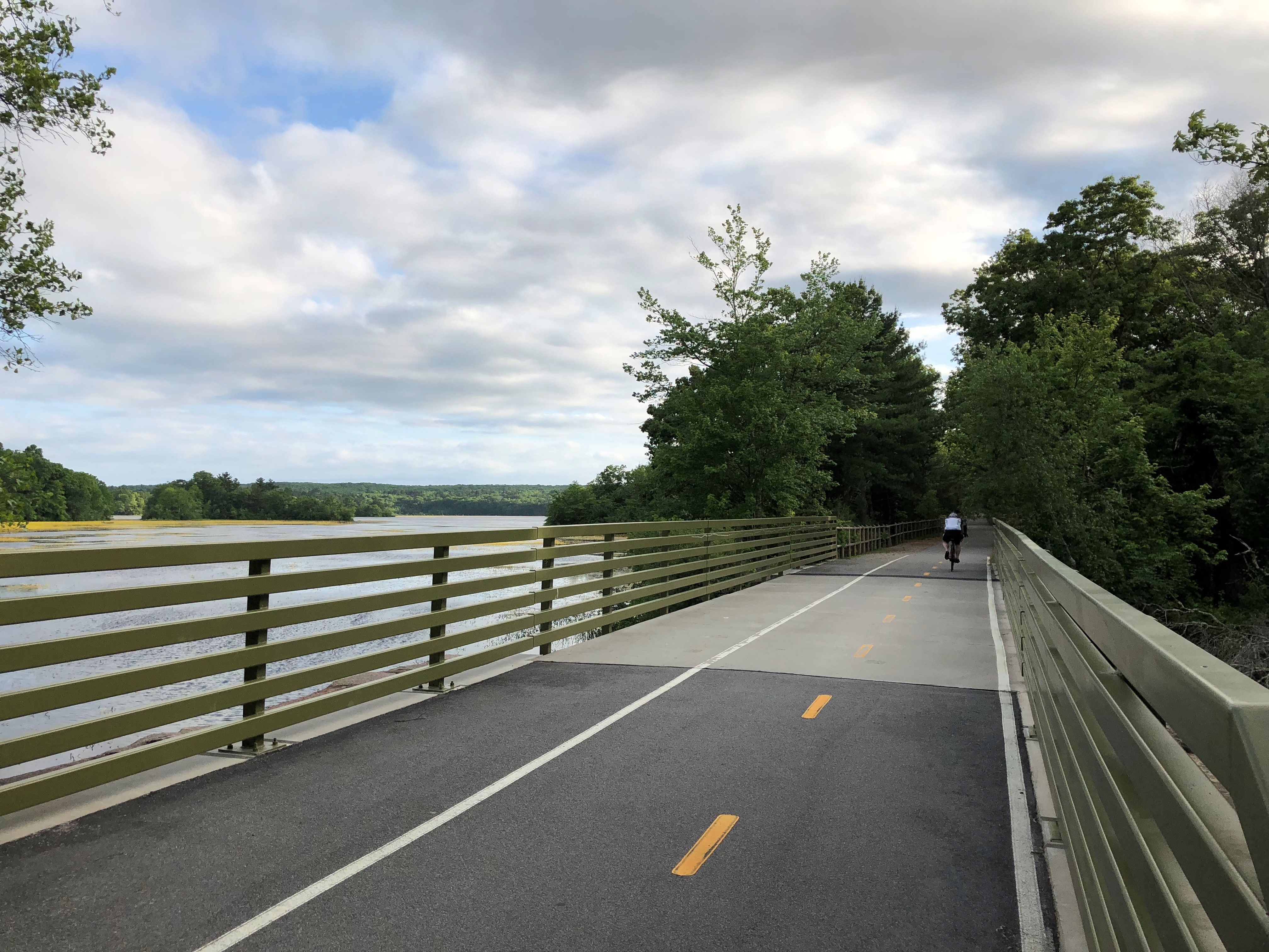
- The Warwick section of the path brings with it the first of many picturesque river crossings, many of which retain the impressive iron truss work of the original railroad bridges.
- You'll notice a slight incline of the path as you make your way west. You're treated to views of numerous old mill buildings and waterfalls as you gain elevation.
- After crossing over a very high trestle near a large mill housing the Bradford Soap Works, keep an eye out for a restored caboose on your left. This is the Riverpoint section of West Warwick, a crossroads of walking trails including the West Warwick Riverwalk to your left and Riverpoint Park on your right. Note: Historic flooding in 2010 destroyed a pedestrian bridge close to the Providence Street end of the Riverwalk. For a longer walk, stay on the bike path until Factory Street, and turn left. The trail head is on the left, after the large bridge.
- The path winds around the Arctic section of West Warwick, and while it is close to this commercial center, the path is mostly wooded as it makes its way to the Coventry town line.
- Two more large river crossings are next, each offering great views of the Pawtuxet River. In a short distance you'll see a sign with access to the homestead of General Nathanael Greene - second in command to George Washington in the Revolutionary War. At the Laurel Avenue crossing, there's a shade structure and canoe launch.
- More recreational diversions are possible as you continue riding into Coventry, first on the left is the town's Whipple Conservation area, with numerous walking trails. Next up is Paine Field and the Coventry Recreation Center. There are restrooms here, playgrounds for the kids and possibly a bite to eat if a ballgame is in progress and one of the concession stands is open.
- From this point to the trail's current end, the path runs through a mostly rural, forested part of town. Recent improvements include an equestrian path that runs parallel to the bikeway and sometimes shares the same footprint as the bike path. Highlights include a new spur path to the Coventry Library and access to Johnson's Pond.
- Past the former end of the path, the bikeway crosses into the Trestle Trail Greenway. Along this 4.8-mile segment, you'll pass through pristine forested areas, over lakes and streams and by historic rail villages. Look for a series of interpretive panels that describe the history of the area and the former railroad. The path ends at Log Bridge Road near Summit General Store, one of the oldest general stores in Rhode Island. The equestrian path continues for the entire length of the trail to Log Bridge Road.
Maintenance Questions
Spot graffiti, trash, or other maintenance problems? Contact the following departments depending on which town you are riding in:
Parking Information
Get directions to public parking along the bike path, arranged from Cranston to Coventry: